
Aeronautics & Technology
![]()
Research & Development
The Flying M Ranch has a long and decorated history in the world of aeronautical research and development.
FMR’s founder, John Wescott Myers Sr. was a renowned World War II test pilot. As chief engineering test pilot at Northrop, he test flew hundreds of planes, from the P-61 “Black Widow” to the flying wing prototypes. Today, FMR provides land use arrangements to companies in aeronautics and technology. FMR offers the vast area and privacy required to safely and securely engage in aeronautics research and development. Please contact us to discuss license agreements and fees.
Fostering Innovation
The Tech’s Playground
FMR’s simple license agreements enable tech companies to conduct research and development in a private and secure location.

Aviation Infrastructure
Cleared for Takeoff
The Flying M Ranch offers a 3,700 foot paved airstrip with three-phase power and facilities to accommodate various flight testing operations.

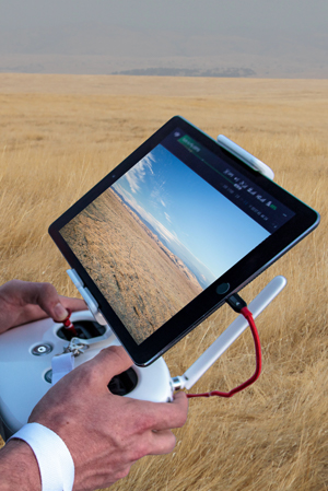
UAS Development
Unmanned Aircraft
With vast areas of privately-owned grasslands, UAS operators are assured visual line-of-sight and minimal air traffic. Airport identifier: CA03
![]()
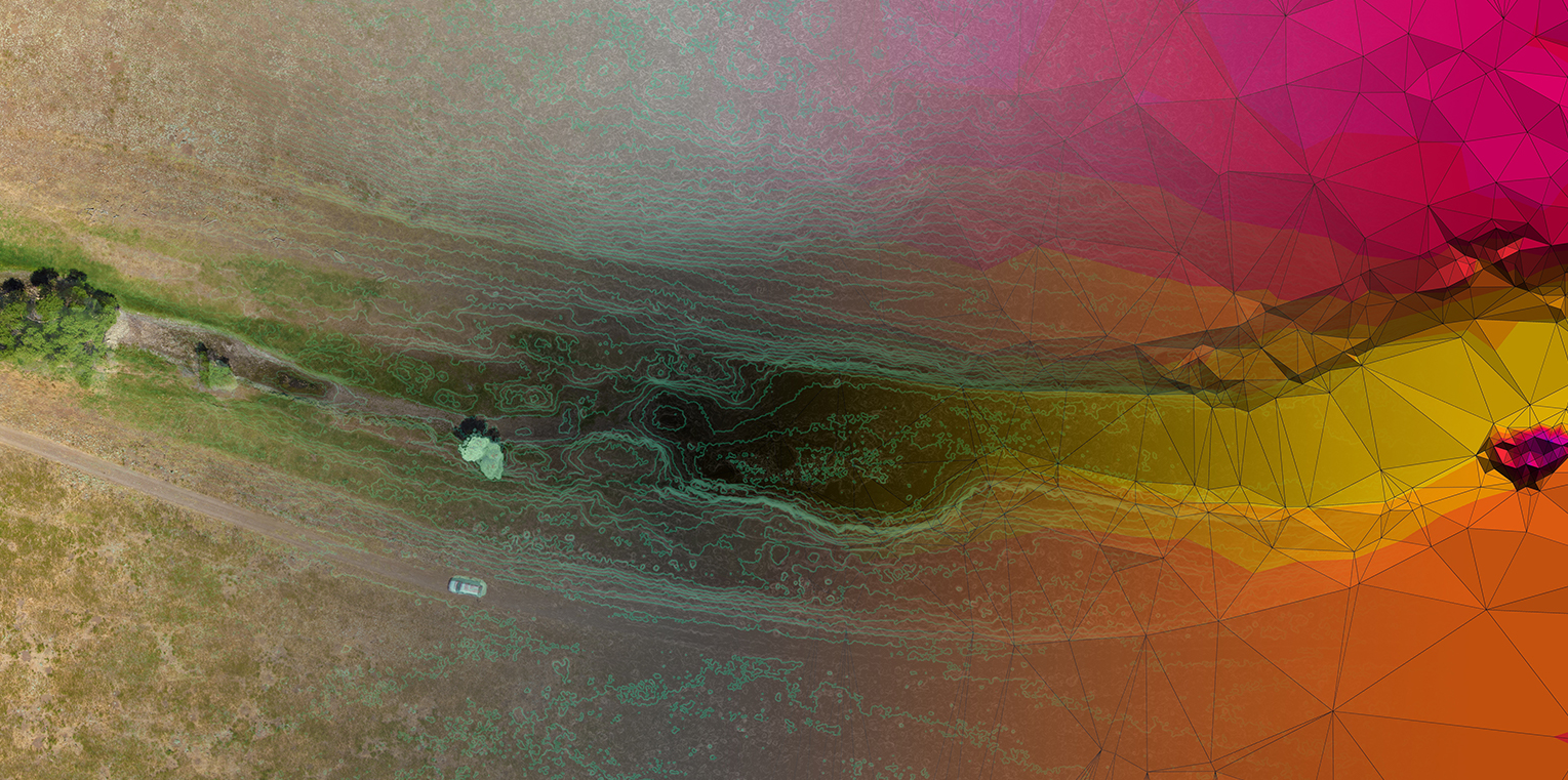
Geospatial Technology
With extensive areas of both grasslands and crops, and unique topographical features, FMR provides an ideal testing ground for geospatial technologies.
Land cover across FMR includes the vernal-pool grasslands of the nature preserve, row crops, perennial orchard crops, vegetated riparian zones, and small water bodies. These land cover types provide varying conditions for testing data acquisition and processing technologies.

Data Collection
Sensor Development
FMR supports companies developing sensors for geospatial applications, and can arrange access to various areas of the ranch depending on your needs.
Data Analysis
Remote Sensing & GIS
FMR’s varied land cover types enable remote sensing and GIS software developers to rigorously test products in differing conditions and environments.
Geospatial Products
Proof of Concept
The FMR landscape offers scenes of exceptional beauty, providing for data and aerial images perfectly suited for promoting products and services.
FOSTERING INNOVATION
To learn more, contact us today!
![]()
FMR Testing Grounds
Privacy and seclusion, just two hours from San Francisco, and four and half hours from Los Angeles.
The Flying M Ranch encompasses approximately 24 square miles (~15,500 acres) of undeveloped and private land. To the west, farmlands create an additional buffer between the ranch and the City of Merced. To the east, FMR extends into the undeveloped foothills of the Sierra Nevada mountains. To the north and south, grasslands extend as far as the eye can see. This extraordinary property creates unrivaled opportunities for aeronautical research and development.

